I had been to Zion National Park, in southwestern Utah, on two previous occasions — enough to establish itself as one of my favorite national parks. Its beauty is stunning.
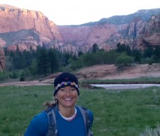
Our approximately 50-mile traverse hike was the idea of Mike Lanza. He recently turned 50, and had conjured up this trek that would commemorate a mile for every one of his years. My friend, Jon Dorn, who took me on the epic Grand Canyon Rim-to-Rim-to-Rim around this time last year, was kind enough to invite me along.
On Friday, I drove 10 hours from my hometown of Lander, WY, to a hotel near Hurricane, UT, located about 40 minutes from our adventure’s start. That evening I had dinner with four of the guys who would be on the trek. (I would be the only woman, hiking with seven men.) After dinner, I set my alarm to wake up — a mere three hours later. Turns out I got a full two hours of shut-eye. Wow.
The cast of characters on the hike hailed from six states, including California, Idaho, Colorado, Montana, Massachusetts and Wyoming. Included: Mike Lanza, creator of TheBigOutside.com, author of an upcoming book about climate warming in our national parks, and northwest editor for Backpacker magazine; Jon Dorn, adventure athlete and editor-in-chief of Backpacker; Mark Fenton, a race walker and bike- and pedestrian-friendly community-building consultant; Carl Schueler, an Olympic race walker who works in land use planning; Todd Arndt, a family physician and competitive runner; David Ports, multi-sport adventurer and the USA YMCA Director; Mark Godley, an avid adventurer and a sales representative for a software startup; and finally, me, a consultant, writer and aspiring life and leadership coach.
In other words, the event would be well documented and widely published, fast-moving, pedestrian-friendly, a good use of the land, well-planned, provided with medical care (medicated, even, perhaps?) and effectively sold. And, if I could keep up, perhaps I could provide some championing and cheering.
By the way, in addition to all the logistics such an epic trek requires, as a group we also agreed not to eat each other no matter the circumstances. No cannibalism. Still, as the only girl on this trip, and knowing how desperate people doing these long adventures can become, I planned to make myself look as unsavory as possible.
We started from Lees Pass, in the Kolob Canyons region, on the LaVerkin Creek Trail. It was 52 degrees at the 3:15 a.m. start and we hiked under a dark, clear sky. For the first few miles, I couldn’t see anything other than the light from my headlamp that illuminated the path in front of me, and the streaming line of little lights from the others.
Once my eyes adjusted, I could sense the huge canyon walls we were walking under and through and I could see the outline of their ridges. They were impressive in size and made me feel like an ant. And we were an awful lot like ants — carrying our loads and moving quite briskly under the enormous canyon walls in a single-file line — with great purpose.
We covered the first six miles quickly and with ease.
After about seven miles we could hear roaring water. Mike commented, “Wow. LaVerkin is running strong.” I started to get nervous as we hiked and the creek’s roar became louder, and closer. I started negotiating in my head the other things he said instead of that the creek was running strong. But I couldn’t come up with any other logical words that rhymed so I remained wound up.
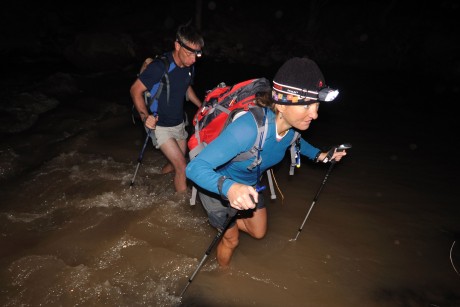
Sure enough the creek was running strong. I’ll say! The creek isn’t wide, but looked deep and swift. I was scared. As we all looked for a good place to cross, Mark (Fenton) decided to give it the first shot. I watched as he got half way across, and was under water to his waist and stopped just short of the other side. I’m not going to lie. For a moment there, I thought he might go down creek. He is a strong guy, and yet was fighting the current pretty good. Finally he stepped up to the other side’s bank, soaked, but safe.
I was scared. I have crossed many rivers, many much wider than this creek. But I had no experience crossing a creek or river as deep and swift as this.
Todd found a little wider, less deep channel and the rest of us opted to take his route. I confided in Jon and David, “I’m just letting you guys know that I’m out of my comfort zone. I’m scared. I don’t have experience crossing deep creeks or rivers.”
Gentlemen that they are, Jon and David offered to go in front of, and behind, me. They instructed me to plant my poles and focus on getting good footing. I found that it also helped for me to look across to the other side rather than down at the swift current. Crossing in between these two strong guys made it easier and before I knew it, I was standing on the other side, wet to the tops of my thighs, but safe all the same. It was exhilarating, not to mention, cold and invigorating.
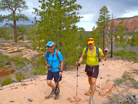
Next up was the Hop Valley Trail. We hit the valley right at sunrise and the sights were amazing. We hiked on a sandy, wet trail amidst breathtaking beauty of towering red walls to our left and right. This stretch of the trail was challenging in that we had to cross a stream that was about ankle deep with no rocks to hop on, about 10 times. We crossed it so often that it didn’t make sense to de-shoe every time. As a result, my feet got quite wet and caked and filled with orange mud during this stretch.
Although this part of the hike was absolutely breathtaking in its beauty, I was concerned that my wet, muddy shoes might present problems for my blister-prone feet, and, by that point, we were not even 14 miles into the hike. This worry weighed on me because I fully intended to make the complete traverse and was intent on preserving my feet for as long as possible. So in the big scheme of things, this wasn’t an ideal start. We also lost the trail a couple of times, which cost us a little additional time and energy. But I’m not complaining; the scenery was too outstanding and the company too awesome.
After about mile 14, we arrived at the Hop Valley trailhead. There, Amy and Lisa, wife of (speedy) hiker Mark Fenton, greeted us with homemade wheat/cinnamon waffles, coffee, yummy homemade trail mix and other gourmet treats. Their smiling faces and cheering lifted my spirits, which had sunk a little out of concern for my wet feet.
Soon we were off again. It was 9 a.m., and it was heating up. We took the Connector and Wildcat Canyon trails to eventually meet up with the West Rim Trail. The four-mile Connector trail is just that — a means to connect to other trails. As we started down the trail I realized how hot the sun felt and that it was only 9 a.m. Not a super performer in high heat, I felt a little more worry set in. Fortunately by 10 a.m., gray clouds filled the sky. I was more thrilled to have cloud cover than concerned about precipitation. This cover persisted and provided significant relief from heat for several hours.
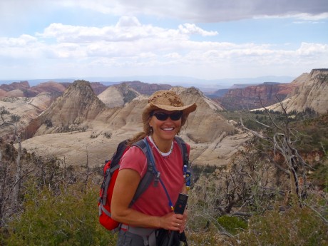
It took quite a while to reach the West Rim Trail but we made up some time and had returned to a pretty swift hiking pace on the two trails that would get us there.
Soon after joining the Wildcat Canyon Trail, I parted company with Mike, Todd and David, who opted for a short side trip to Northgate Peaks. (Jon, Carl and Mark F were ahead on the same side trip) I opted to continue onward. My goal was to make the traverse, rather than hit a particular total distance in miles for the day and I remained focused on preserving my blister-prone feet for as long as possible, which for me, meant not adding any additional miles.
I hiked alone for just under six miles before reaching the West Rim Trail. I took my shoes off to soak my feet and cross Blue Creek. Because I was now ahead of the others, I took my time to sit on a rock and air-dry my feet, change socks again, and consume some high-energy calories, before continuing and shortly arriving to the West Rim Trail.
This was a big deal, getting to the West Rim Trail. I have heard many times from people, and in articles I’ve read, that Zion’s West Rim Trail is absolutely spectacular. In other words, I was about to enjoy some serious payoff for my efforts thus far. I couldn’t wait to see what all the fuss about West Rim was about.
I waited for a bit to see if any of the others would show up. About 10 minutes later I heard voices and greeted Mark, Carl and Jon. Together we found a shade tree, where they all removed shoes and took a short break. Because I had enjoyed the recent break at Blue Creek, and given my eagerness to see West Rim’s sights, I opted to continue. Jon said he’d wait up for David and Mike, and I was off.
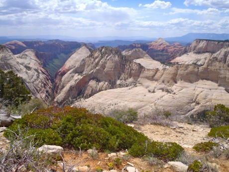
The West Rim Trail is long. It is 14.5 miles from its start to the Grotto Picnic Area, in Zion Canyon, situated on the park’s main road. For the first six or seven miles the trail is unspectacular, offering a great view of Wildcat Canyon, but not much else. It follows a pretty even grade until dropping into Potato Hollow. It wasn’t long, and speedy hikers/race walkers Mark and Carl showed up. I enjoyed hiking with them for a couple of miles, during which Todd also caught up.
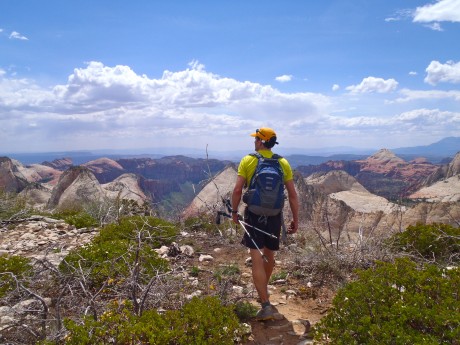
We relieved our feet with a quick break, and a water re-supply in the non-scenic, burned (read: un-shaded) Potato Hollow area.
Carl and Mark jetted ahead from there, and Todd and I hiked together along the West Rim of Zion. We were both complaining, if only slightly, about the lackluster views for what was reported to be a trail known for stunning vistas.
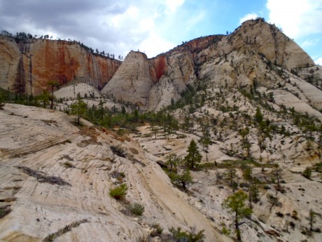
As if on demand, everything changed. In front of us for the next several minutes was an unfolding, labyrinth of canyons. We were completely wowed. We stopped several times to just look at the jaw-dropping views before us. As if the views weren’t quite enough, there was an assortment of brand new flowers in bloom along the Rim trail. Absolutely stellar views.
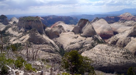
After following the West Rim, the trail descends into and in and out of the unique and massive rock formations, for which Zion is famous. The geology of Zion includes nine formations that, combined, represent 150 million years of mostly Mesozoic-aged sedimentation. Back then, warm, shallow seas, streams, ponds and lakes, vast deserts, and dry near-shore environments covered the area. Uplift associated with the creation of the Colorado Plateau lifted the region 10,000 feet starting 13 million years ago.

The North Fork of the Virgin River carved Zion Canyon, and during the later stages lava flows and cinder cones covered parts of the area. While hiking up, down and through these unique and massive cone-shaped formations, I couldn’t help but feel quite insignificant in the spectrum of time.
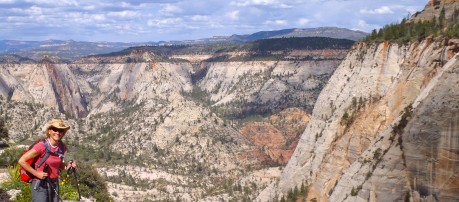
At around mile 35, Jon caught up with Todd and I, and we consumed with much enthusiasm some Twizzlers (red licorice goodness) that were in Jon’s pack.
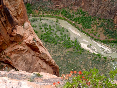
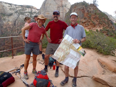
Shortly after, about 12.5 miles into the 14.5-mile West Rim Trail, we reached the spur for the noteworthy Angels Landing trail. Because I had hiked Angels Landing on a previous trip, I opted to sit this side trip out, while Jon and Todd, and Mark and his wife and daughter hiked to Angel’s Landing.
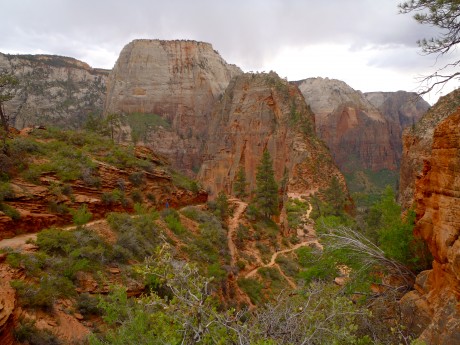
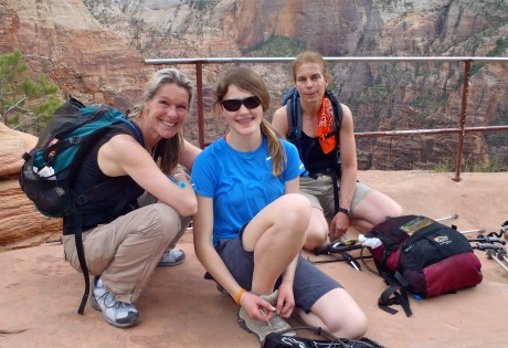
After a good rest, I headed down the remaining two miles into Zion Canyon to the Grotto picnic area. There, Mark Godley greeted Todd, Jon and I with sandwiches and raisin and oatmeal cookies I had made. And let me tell you, this real food hit the spot.
Next up: a 2,500-foot climb up, and several more miles of hiking to meet up with the East Rim Trail, which would lead to the trek’s finish at the Park’s East Entrance. I think it was about 7:30 p.m. when we caught one of Zion’s free shuttle buses up the road to the Weeping Rock Trailhead. Remaining distance to the end of this walk in the park: 10.5 miles.
Once off the bus, Mark, Todd, Jon and I proceeded to climb several steep switchbacks before passing through the awesome and unique Echo canyon, and up, up, up before accessing the East Rim Trail. For a small bit, right before total darkness, we had a hard time remaining on the trail, which was marked by cairns on steep and uneven rock. We reached an elevation of about 6,500′.
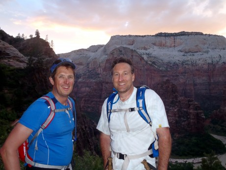
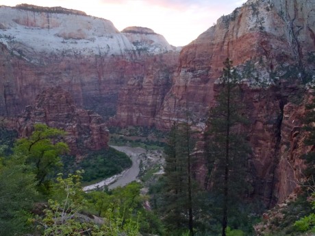
By now, there was no more twilight so we had our headlamps on and despite the black sky, the almost-full moon lit up the ridgelines of what were very obviously massive walls and cliffs around us. I made a mental note to hike the East Rim Trail sometime in the daylight. I am pretty sure the sights are astounding.
At about six-and-a-half miles into our final stretch, we came across the stash of Gatorade that Mark G had earlier in the day cached for us. Grape Gatorade never tasted so good. With about four miles left, I told the others the news – that many of my previously-prospective blisters were now full-on open and/or torn actual problems, and that I was feeling the pain in my feet. I told them I was perfectly okay, but that they should go on ahead and that I was going to resort to listening to some music via my iPod to help me get the gumption necessary to finish this thing standing up.
I didn’t lie. My feet exploded with pain. Each step felt like I was walking on hot coals but with pins and needles also injected in between my toes, on my heels and on the balls of my feet. I’m not complaining; I’m used to blisters on my feet on these endurance hikes. And thankfully these didn’t pose problems until this point – four miles from the finish of a traverse hike across a national park. So, yes, I did choose to slow it down some, and to “dig deep” with the help of some inspirational music.
But, in the interest of full disclosure, it’s at this point of these hikes – the last few miles – that the experience becomes deeply spiritual for me. At this stage, it becomes for the first time clear that I will succeed in finishing. This makes me quite emotional. There are often tears. I shed them mostly in gratitude. I think of my husband, Jerry, and our three sons, and of their love and support. I think of my parents, and my sisters and brother and their families; of my extended family and the dear friendships and relationships that nourish and support me, and that make my life so rich. I think of the hard training I do so that I can participate in these unique endurance adventures when the opportunity comes along.
And, it is true, at this point, I’m physically exhausted, sleep deprived and due to the blisters on my feet, in serious pain. So, while I didn’t want to slow the boys down, and while I planned on being introverted as I listened to my iPod, I also wanted to be alone for the finish. The final stretch is quite personal for me.
The last four miles, which seemed more like ten miles, were surreal and beautiful. There was an almost-full moon that illuminated the sand and rocks that marked my trail, and made the slick rock to my left glow sharply white. Also worthy of noting is the fact that the final stretch drops some 2,000 feet through a Ponderosa forest. Once, a bat fluttered by my ear, and I could hear the sounds of night creatures stirring even over the soft playing of Beethoven and Enya in my ears. Stars were out as I marched, slow but deliberately, toward what would eventually be The End of this adventure.
With probably two miles remaining, I came to a water crossing. The guys were waiting there to see how I was doing and to let me know “there’s a huge gorge/waterfall to the right. Cross right near it.”
Wow. This sounded exciting. Sure enough, as I rock-hopped across, I looked to my right, down what was a rather significant gorge/waterfall. Suffice it to say you would not want to get disoriented or wobbly while catching a glimpse. (Turns out that this feature is Jolly Gulch.) And jolly, I was becoming, knowing I would soon be off my feet, and possibly even drinking a cold beer.
About an hour later, I was greeted by laughter and a bit of a tailgate party, complete with beers and bags of chips and, heck, even Twinkies, being offered by my fellow hikers, Mark, Jon and Todd. Yeehaw! While I skipped all the side trip hikes, I think with my gazillion, off-trail bathroom hikes, I may have closed in on 50 miles… 🙂 But if I didn’t, who cares?
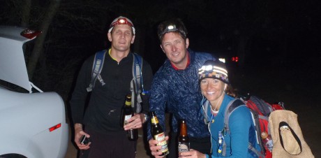
After this traverse, I have a more intimate connection with Zion National Park. I will be inspired for weeks and months – forever – by the sights that I saw, the acquaintances I made with all the guys on our trip and our support crew, and as a result of having accomplished a physically demanding pursuit.
When I learned I’d be the only girl on the hike, I was a little worried. Mind you, it’s not that this is that unusual for me to be hiking with mostly boys. After all, I’m outnumbered in a similar way at home, where my husband and I live with our three sons and our male puppy.
I didn’t want to slow the group down, or be a liability to anyone. I was honored to be invited and to be permitted to tag along with these accomplished adventurers. And, I wanted to successfully complete the traverse.
The men were all gentlemen and I am better for making their acquaintances. They, and the conversations I shared with them, enriched my experience.
VIDEOS:
HOP VALLEY VIDEO:
WEST RIM TRAIL VIDEOS (6):
EAST RIM TRAIL VIDEO: