Hi. My name is Shelli Johnson, and I am rich. In fact, I can’t believe how rich I am.
Here’s my secret:
hiking
Surf, Rolling Hills, Lung Busting & Zen
Those of you who know me and/or who read my blog, know that I live on the frontier of Wyoming and that I LOVE Wyoming and my “back yard”, the beloved Wind River Range.
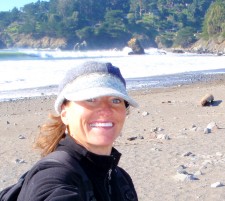
But, I am also falling in love with the San Francisco area — specifically the Marin Headlands.
Don’t worry, friends and family, I will not leave my heart here in San Francisco. My heart is in the Wind River Range of Wyoming.
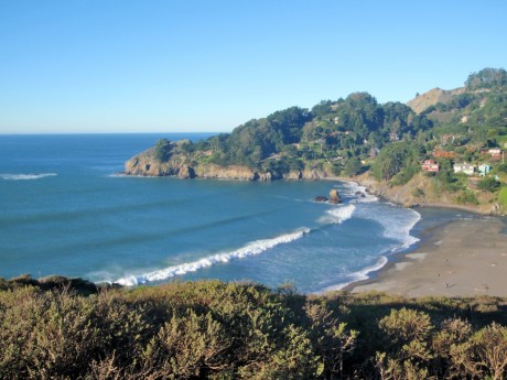
What helps me love this place are days like the one I experienced Thursday.
(Note: I am here for my third of five weekends of learning and developing my life coaching skills at The Coaches Training Institute.
Because it can be, well, difficult, to get this girl out of the frontier and often travel doesn’t go as planned, I build a buffer day into these trips. I depart out of Riverton, WY, on Wednesday afternoon and arrive here Wednesday night. Thursday is a free day to allow for travel if plane doesn’t show up on Wednesday afternoon to take me out of the frontier.
Fortunately, I was able to get out and arrived here Wednesday night, which meant Thursday was all mine and I wanted to further experience the outdoor beauty of this area.
Last month, I hiked from surf to summit. Read more about that amazing hike from Stinson Beach to top of Mt. Tamalpais.
The adventure started at Muir Beach, and it was cold! I quickly learned that 41 degrees and windy, at sea level, is colder than same conditions in my high and dry Wyoming. Fortunately, I had packed some “Wyoming winter clothing.”
I hiked from Muir Beach, along the Coastal Trail, to Pirates’ Cove, to Tennessee Valley, up to Coyote Ridge and then to and through Green Gulch organic farm and Zen Center back to Muir Beach. All told, it was about seven or eight miles and 1,600′ or so of elevation gain.
It was a spectacular hike. By my standards, which are high due to the beauty and ruggedness of the Wind River Range, I rate this hike as “epic” for many reasons, which I’ll share with you here.
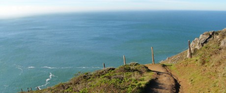
Despite the cold start, there was blue sky as I hiked the “shore-hugging” Coastal Trail. This stretch provided awe-inspiring scenery, with the Pacific Ocean surf “crashing” against the shore below and a trail that provided just enough lung-busting to keep me warm. The wind was howling but invigorating all the same.
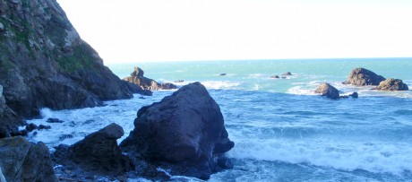
About 1.5 miles into the hike, after a short downhill hike to the shore, is Pirates’ Cove. From my understanding, this is a location where people would bootleg liquor during the Prohibition. (As far I could tell, today there no is hooch to be had.) I stood for a few minutes just to listen to and feel — to fully experience — the ocean’s power and sounds and smells. This is a great little cove and worth the side trip.
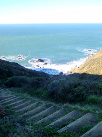
From there, I continued toward Tennessee Valley, a lush, rolling valley that is home to some big raptors and other wildlife. This part of the hike was surreal, as I hiked in and out of low clouds and mist.
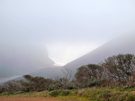
Next, I left the Tennessee Valley Trail and headed up to Coyote Ridge. From top of the ridge, I had panoramic views that were a little tempered by low moving clouds and fog. This was a long, sustained, pretty steep uphill, which suited me just fine. I hiked pretty steadily up for 20 or so minutes before reaching an intersection of trails.
Once up the hill, I continued toward Middle Green Gulch before finding the Green Gulch Trail. I had a tip from a friend, Chad, who is a local, who described the Green Gulch Farm, home also to a Zen Center, as “well…very…Zen…very, very special!!!”
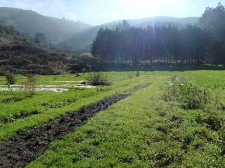
After hiking up and around some ridge-tops and hills and through a string of Eucalyptus trees, I arrived at the Green Gulch Farm & Zen Center. Here, I won’t lie, I felt a little lost and like I was trespassing, not sure if I was “on the right trail,” but was greeted by a nice gentleman who provided some great interpretation for me.
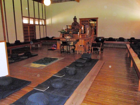
I learned that Green Gulch is an organic farm and Zen Center, that among other things, hosts about 70 Zen students at a time. I stopped in the small store where a nice woman and man were working. I bought some tea and before continuing on my way, I asked, “Well I’m from Wyoming and I’m trying to fully experience this area today. Is there anything you can offer me in terms of Zen enlightenment or tips to take with me?”
This was great! One told me to “breathe.” The other suggested, “Don’t believe everything you think.” Wow, glad I asked! One of these would have been enough to think around, so I was particularly grateful.
Next, I stopped into the Zen Temple. Unfortunately there was no meditation until later in the day so I couldn’t experience that, which I’m sure would have been an amazing experience. But I talked briefly to an Asian monk there. He didn’t speak English but after trying my best to communicate what I was doing and that I was “sorta lost… I’m from Wyoming and hiking through here … do you have any thoughts for me?” he said, in a very friendly way, to “Just Be.”
What a perfect way to end an amazing hike. I hiked through the farm fields and was soon back to the start, Muir Beach.
To cap the hike, again on a tip from a friend, Sean (also known as S.O.S.), who’s a local, I stopped by the historic and wonderfully quaint Pelican Inn, a bed and breakfast, complete with dining room and pub, that is right near Muir Beach. Capturing the spirit of 16th Century England west country, this place is incredible and should be a must-see for anyone who visits the Muir Beach area. Here, I had a wonderful salad of organic greens and a cup of spearmint tea.
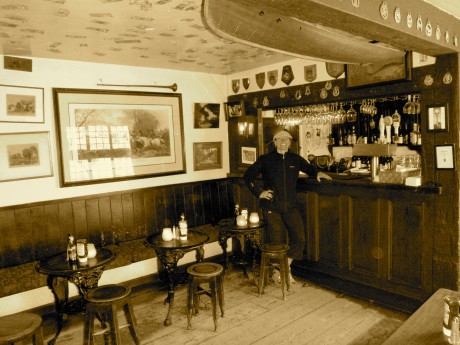
It was a perfect day that included new and awesome scenery, some great exercise, invigorating, fresh, coastal air, solitude, Zen and culture!
But wait, still not over. The day was capped when I visited some friends for dinner, which included delicious fresh salmon (a real treat for this Wyoming girl!), and other great eats, completed by some great conversation.
The only thing that could have made this day better would have been to have my husband, Jerry, and our three sons, Wolf, Hayden and Fin, with us. So, I’ll be working on reliving this day with them the next time…
But, like I said, I’m starting to fall in love with this place.
Videos:
MUIR BEACH TO PIRATES’ COVE:
TENNESSEE VALLEY TO COYOTE RIDGE:
GREEN GULCH FARM & ZEN CENTER:
Acknowledgements:
Thank you Josh Steinitz, Chad Herst, Doug Peck and Sean O’Sullivan for providing tips that helped me have this amazing experience while visiting your neck of the woods.
From Surf to Peak, Mt. Tam is Epic Hike
I was recently in the San Francisco, CA., region for my life coaching training.
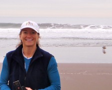
I arranged my travel to arrive one day early so I could do a little exploring. I also did this because getting the girl out of the frontier does not always go smoothly so it’s necessary to provide a “buffer day.”
Turns out my flights went like a dream and I arrived on schedule, which meant I had a whole day — including transportation in the form of a rental car — to explore.
My choice for the sightseeing day: Hiking to top of Mt. Tamalpais. Locals refer to this mountain as “Mt. Tam.” The mountain, which is situated in California’s beautiful Marin County and is visible from San Francisco, reaches 2,574′.
What an amazing mountain and an awesome hike this was for me. I hiked from surf, through large redwood forests, lush, mossy/rainforest-like sections that had mist and waterfalls, and mountain terrain to the top of East Peak, the second highest point of the mountain, which reaches 2,572′
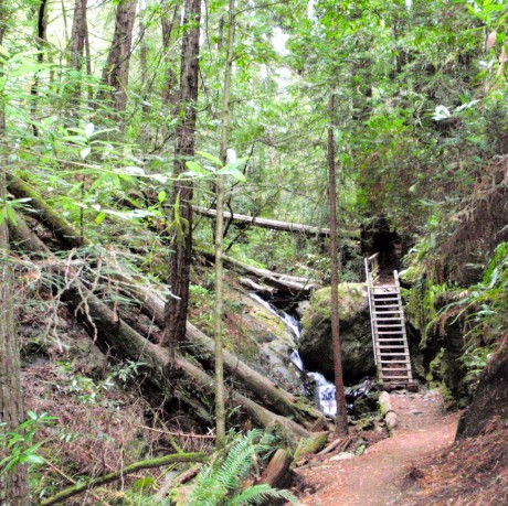
The mountain is part of the Northern California Coast Ranges. Despite being smack dab in the middle of a pretty heavily populated region, much of Mt. Tam is protected by Mount Tamalpais State Park, Muir Woods National Monument and the Mount Tamalpais Watershed.
There is a large network of trails. I was able to hike several different trails. As a result, I was able to experience new sights and terrain along the way up and down. I hiked the famous Dipsea Trail and Steep Ravine Trail to Pantoll Ranger Station, then Old Stage Road, Nora Trail, Fern Creek Trail, Matt Davis Trail and the Coastal Trail.
To hike only to the Pantoll Ranger station and back, using different trails going and returning, it’s about seven or eight miles total. To continue linking various trails from Pantoll Ranger Station to the top of East Peak makes it a 14- to 16-mile hike, depending on how often you want to explore different trails that take you a little further.
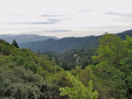
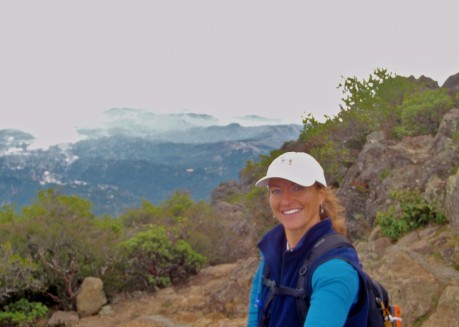
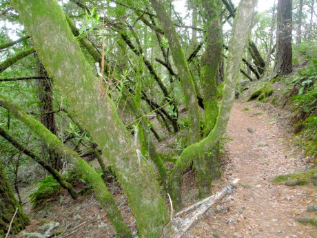
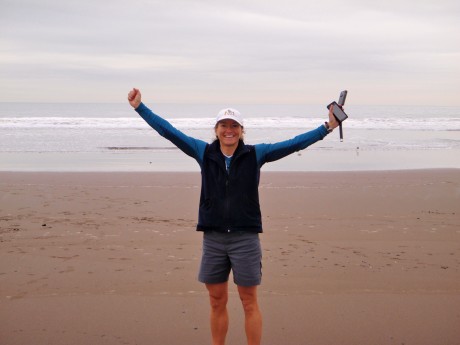
The weather was not perfect. Actually it was perfect temps for uphill hiking. But there was fog and mist and clouds, making it hard to truly capture the views that this hike affords. At times it was hard to determine where the separation between clouds and oceans was. But hey, mist and fog are things this Wyoming girl is not used to, so perhaps they added to the experience. This was a glorious hike and one I will never forget.
Some notes:
It took me more time than it should have to drive to Stinson Beach because I took some wrong exits and turns in route. (My bad for second-guessing my Droid’s navigation lady.) But the drive was beautiful. Much of it was on the winding California Highway 1 and revealed gorgeous beach and ocean views throughout. Also, I love Stinson Beach, which is a quaint, beautifully-set unincorporated community situated at 26′ elevation.
I had a much more difficult time finding the trailhead. I was expecting huge signs and big parking lots at the trailheads. After all, a lot of people live in this area and travel to this area. Mt. Tam is a popular local hike and a popular place for visitors to go. I was wrong. The trailheads were simply little signs near streets. Actually they were very tactfully marked. I just wasn’t focusing hard enough.
Also, on the 15 or so miles I hiked, I saw (and spoke briefly with) only about eight people. It was more like my hiking experience in Wyoming than I would imagined on that front on this particular day. Everyone was super friendly, including the two flower children/hippies that hugged me and wished me good karma while meeting me on the last stretch of trail to East Peak.
Finally, thanks to my friend, Josh Steinitz, CEO of NileGuide, for suggesting this hike!
Another Best Wind River Hike, Ever…
I have had a great four months. My beloved Wind River Range has been good to me. I have been lucky enough to experience seven or eight long and stunning day hikes in my back yard plus a bunch of smaller hikes and outdoor adventures with my family.
Most recently, my husband, Jerry, and I hiked up (and down) and up to the end/top of Roaring Fork Mountain. The mountain itself it not that spectacular. Its high point is a little over 12,000′. But the mountain is broad, and as its name suggests, it forks into what are two pretty long mountains/ridges that are all part of The Roaring Fork. We are pretty sure the Roaring comes from the roaring nature of the wind, but we’re only guessing?
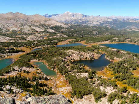
There are two reasons this hike was/is so special to Jerry and I. For one, we can see this mountain from most of the hikes we do in the southern Wind Rivers as well as from the deck of our mountain cabin. The Roaring Fork, complete with its notch (“bite”) in its summit ridge, are iconic if you live and play in the mountains above my town of Lander, WY.
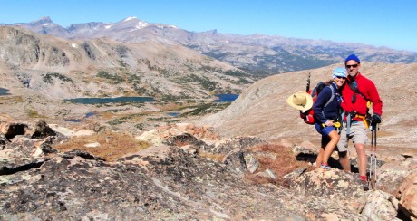
The second reason is Roaring Fork Mountain juts out of a landscape composed of regions marked by spectacular canyons, cirques and lakes. We have hiked into, or taken llamas into, most of these awesome regions. Standing on the top of Roaring Fork and getting up-close and more intimate with it, was quite a meaningful experience for us.
I wish I could take credit for thinking up this hike, but I can’t. A friend, Jared Kail, has talked about wanting to do a version of it for some time. For his 40th birthday he was going to hike it and invited us along. Unfortunately, he came down with a cold the day before and had to forego it. But I owe Jared for thinking of the hike.
I have pretty much hiked and camped in and explored a good majority of the trails in the southern Wind River Range. And yet, somehow this one eluded me until last Sunday. And, turns out, it’s a major favorite. I cannot wait to return when I have more time to explore the mountain even further.
For the record, we did a long version. We did an out and back. We started at Worthen Reservoir and hiked the Stough Creek Lakes Trail for almost 4 miles to the Stough Saddle. This saddle is a favorite day hike that affords one of the best views of Wind River Peak, the tallest peak in the southern Winds, standing 13,192′ tall. (Jerry and I climbed it in 1997.)
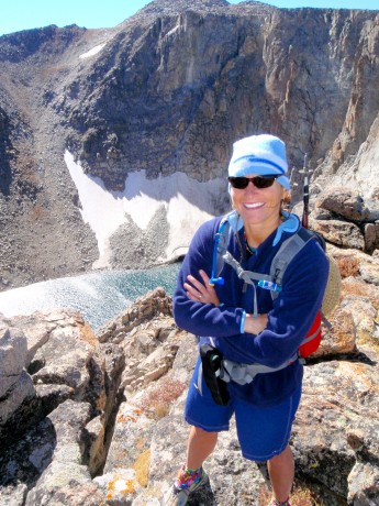
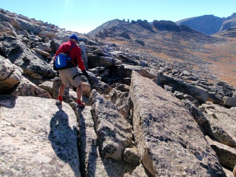
From there, we headed left, off-trail for approximately five miles of tundra, scree, boulder field hiking. It was quite windy in the Winds! The Winds, as well as the Roaring Fork lived up to their names on Sunday. But no complaints — we had a perfectly brilliant Autumn day for the adventure.
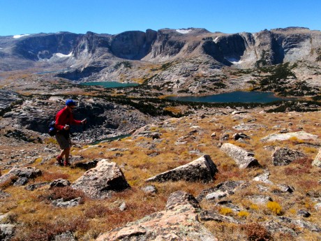
We had jaw-dropping, awe-inspiring scenery pretty much constantly, and in all directions. To our right, for the five miles we hiked toward the end/high point of Roaring Fork Mountain, numerous lakes and cirques unfolded to our right that make up the spectacular Stough Creek Lakes Basin region. At any single vantage, we could count six to seven lakes and cirques. This is how it was the whole way to our right.
To our left, especially when we gained the high point of the ridge, we had similarly spectacular views, including the Roaring Fork Lake/Creek, Leg Lake, Silas Canyon and its lakes, Atlantic Canyon and its lakes, not to mention Fossil Hill, Frye Lake and Worthen Reservoir. And, let’s not forget the view that unfolded behind us, which was basically one containing most of the southern Wind River Range, complete with iconic Wind River Peak, Temple and East Temple Peaks and Lizard Head peak standing out. We could also see Shoshone Lake, the lake we hiked to the previous week.
Another friend of ours, Mike Lilygren, had hiked a different variation of the same hike a week prior and provided invaluable input to us the night before. Basically he instructed us to not head directly over the rocky mounds immediately to our left of the Stough saddle, but to instead keep them to our left. This was great advice.
Still this adventure found us ascending to 11,000, then descending 200′, then gaining 400′, then descending 200′ and so on. All told we hiked out about 9.3 miles and gained 6,600′ in elevation gain due to the aforementioned contour of the mountain (and due to our route-finding decisions).
By the time we were back at the car, our GPS indicated we had ascended 7,900′, despite the fact our high point was just about 12,000′ for the day, and hiked almost 19 miles. There are ways to make this hike a little shorter and probably have a little less elevation gain/loss, but that’s another conversation. And, um, we like ’em long. 🙂
VIDEO BLOG OF THE ROARING FORK HIKE:
LINKS TO MY OTHER HIKING ADVENTURE POSTS:
Good Views Come to Those Who Hike Uphill
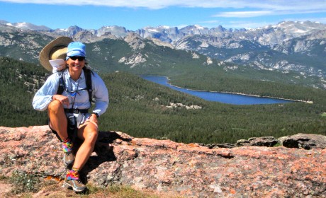
I just returned from my annual hike to Shoshone Lake above my town of Lander, WY. There’s no other way to describe this 22-mile hike. It’s a grunt.
The trail is not necessarily spectacular, and in fact much of it follows a two-track and is a popular ATV trail. Solitude isn’t the reason you hike to Shoshone Lake. But I’m not complaining!
As long as you’re willing to go uphill for a long time on a steep, rugged, loose and rocky trail, and then downhill for a long time on a steep, rugged, loose and rocky trail, then this hike is worth it. The rewards make it so.
A good friend, Kathy (Doyle) Swanson, of Casper, WY, joined me on the hike. We started beyond Sinks Canyon State Park, about eight miles southwest of my hometown of Lander, WY, at the base of Fairfield Hill.
We started at 5 am, with headlamps on, with a 1,000-foot elevation gain over one mile. Along the way to Shoshone Lake, we hiked through McMahone Park, by Pete’s Lake, Twin Lakes, and through the vast and awesome Shoshone Basin.
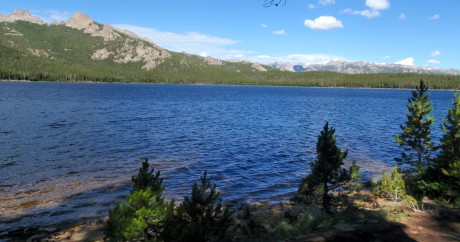
Shortly after hiking through Shoshone Basin and alongside a creek for a short bit, after about 11.5 miles of hiking, we arrived at our first reward: Shoshone Lake. The mountain lake is huge and scenic. For about a mile or so, we hiked along the lake’s shore.
The second, and biggest reward, is what one sees from the top of Cyclone Pass. And the effort it takes to get to this point makes it even more grand. (I’ve done this hike every summer for the last five summers. Every time, regardless of my fitness level, Cyclone Pass is a lung-buster.)
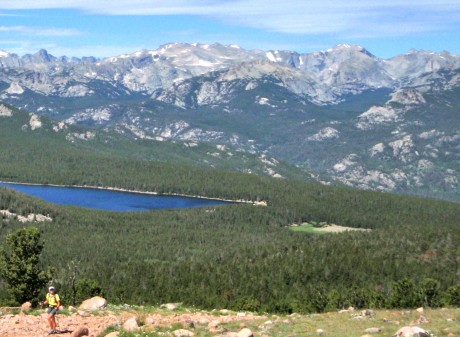
Basically, at about mile 14 of this epic day hike, we faced a rocky incline that climbs close to 1,000 feet in a little over a half of a mile. It’s a combination of where in the hike this uphill grunt presents itself, and its steep nature that makes it grueling. Every time.
No matter that this was my fifth time to see the view from Cyclone Pass. Every time I see it, I am overcome with emotion — i.e. goosebumps and happy tears. One thing I like to do when I have Shoshone Lake first-timer hikers with me is make them promise to not look back while ascending Cyclone Pass. The temptation is huge, if for no other reason you want to stop and catch your breath and take a look around.
I made Kathy promise me she would not look down or back. As far as I know, she kept her word. :>
When we got to the top I told her she could finally look behind her. Watching her take in the view for the first time was almost as great as taking in the view for the first time myself. She was stunned, as you’ll see in the first embedded video near the bottom of this blog post.
After about 20 minutes of taking in the views, taking some video and photos, and snarfing a gourmet PB&H “rollover,” we were on our way to Point B, the point at which my husband, his dad, and my three sons would await for us in a car that would drive us back into Lander.
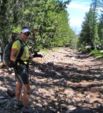
The way back, although it’s almost all downhill, is not for the faint-of-heart hiker. “The Chute” is the most notable reason for this. It’s a 1.5-mile long section on what resembles a dried up creek bed — make that a downhill, dried up creek bed with extra layers of rock for good measure.
Here you walk on rocks and more rocks downhill. It seems like it goes for at least three miles, but it’s one and half miles. Trust me, that’s plenty.
We made really good time on this hike, but The Chute (Yourself?) always slows you down. You can only walk so fast on piles of rocks without turning an ankle or falling down.
We ended near the Switchbacks on Shoshone Lake Road, above Baldwin Creek road. Jerry and his dad awaited us at the top of the last stretch of trail with cold beers in hand (with our names on them.)
It was another awe-inspiring day in my back yard.
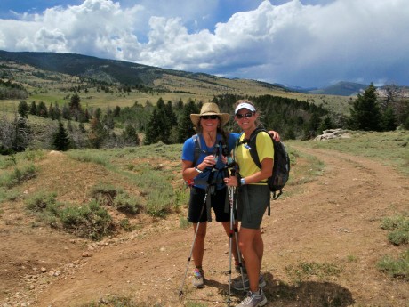
Some video clips of the hike: