“Because in the end, you won’t remember the time you spent working in the office or mowing your lawn. Climb that goddamn mountain.” (Jack Kerouac) Or go to Iceland. We returned from our epic Iceland trip on June 25, and I have been trying to write this blog post ever since. For 10 days now, … [Read More...] about Iceland: A Country Whose Slogan Should be “Whoa”
Main Content
Featured Story

Iceland, Part 1 of 7: Blue Lagoon, Kerid Crater, Seljalandsfoss, Sólheimajökull Glacier, Skogafoss and Reynisfjara Beach
Finally, after disembarking from our 7.5-hour, direct, redeye flight from Denver, we had feet on the ground in Iceland! The anticipation as we landed and walked to baggage claim was palpable. This epic trip had been in the works for several months and finally, we were here. After fetching our … [Read More...] about Iceland, Part 1 of 7: Blue Lagoon, Kerid Crater, Seljalandsfoss, Sólheimajökull Glacier, Skogafoss and Reynisfjara Beach
Featured Story
Iceland, Part 2 of 7: Katla Ice Cave, Skeiðarár Monument, Vatnajökull, Skaftafell, Svartifoss and Svínafelsjökull Glacier
“When I travel, I travel not so much to move, as to be moved.” –Pico Iyer Our Day 3 in Iceland was sure to be epic. A few months ago, we signed up to go on a guided "Super Jeep Tour and Ice Cave Exploration" and today was the day for that adventure. "Hawk," a native Icelander who could be mistaken for a Viking, would be our guide. It was only minutes after loading into Hawk's jacked-up … [Read More...] about Iceland, Part 2 of 7: Katla Ice Cave, Skeiðarár Monument, Vatnajökull, Skaftafell, Svartifoss and Svínafelsjökull Glacier
Previous Stories
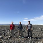
Iceland, Part 3 of 7: Fjallsjokull, Jökulsárlón Glacier Lagoon, Diamond Beach, Lítanesfoss, Hengifoss and Seydisfjordur
On our epic family trips, we keep a family journal. Every evening, all five of us reflect on the day and its adventures and write our thoughts in the … [Read More...] about Iceland, Part 3 of 7: Fjallsjokull, Jökulsárlón Glacier Lagoon, Diamond Beach, Lítanesfoss, Hengifoss and Seydisfjordur
Iceland, Part 4 of 7: Studlagil Canyon, Dettifoss, Viti Crater, Hverfjall Crater, Lake Myvatn, Godafoss, Haifoss, Stong and Gjain
By now, I think the tourism slogan for Iceland should be, simply: Whoa! I have found myself saying this word more times in our short time in Iceland … [Read More...] about Iceland, Part 4 of 7: Studlagil Canyon, Dettifoss, Viti Crater, Hverfjall Crater, Lake Myvatn, Godafoss, Haifoss, Stong and Gjain
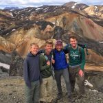
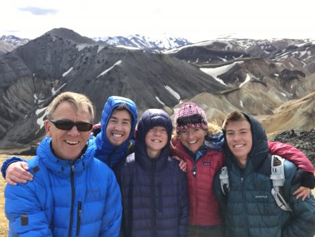
Iceland, Part 5 of 7: Epic Hiking and Exploring in Landmannalaugar
Apparently, Iceland's most famous musician, Björk, used to walk across Iceland's tundra singing at the top of her lungs. In an article in The … [Read More...] about Iceland, Part 5 of 7: Epic Hiking and Exploring in Landmannalaugar
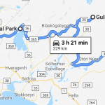
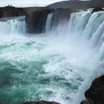
Iceland, Part 6 of 7: Gullfoss, Þingvellir National Park, Reykjavik and the Secret Solstice Music Festival
We left the Highlands of Iceland today and headed for Reykjavik. Along the way to Reykjavik, we stopped at the gorgeous Gullfoss and also spent … [Read More...] about Iceland, Part 6 of 7: Gullfoss, Þingvellir National Park, Reykjavik and the Secret Solstice Music Festival